Looking for the best topographic surveyors in Chennai? We’re here to help.
Before you start any construction or building work in Chennai, you need a good land survey. A topographic survey is a special map of your land. It shows the level, slope, and shape of the ground.
This map is very important for your engineer and architect. It helps them design your building correctly and safely. It also helps to avoid costly mistakes.
At World Survey, we are expert topographic surveyors in Chennai. We use modern technology like GPS and drones to make very accurate maps. We give you clear data for your construction project, house plan, or factory design.
Choose us for reliable and accurate land surveying in Chennai. We help you build your future on a strong foundation.
What Is a Topographic Survey?
A topographic survey, or contour survey, is far more than a simple map. It is the foundation of every successful construction and infrastructure project. It captures the natural and man-made features of a site, including:
- Elevation changes
- Contour lines
- Drainage paths
- Trees, buildings, and roads
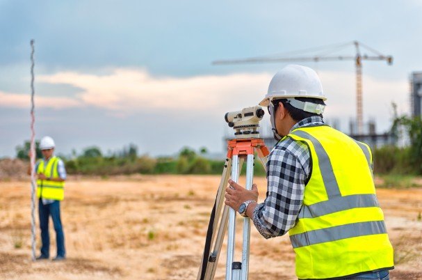
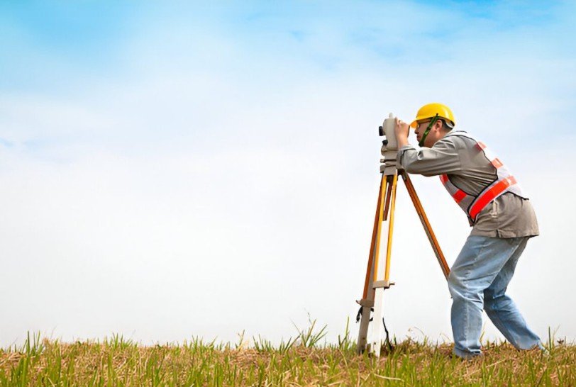
Using advanced tools like Total Station, DGPS, and drone mapping, our surveyors create detailed topographic maps that support planning, design, and compliance.
We specialize in delivering accurate topographic surveys, ensuring engineers, architects, and planners get reliable data for smooth project execution.
Why Topographic Surveys Matter in Chennai
Chennai’s rapidly growing urban landscape demands precision in land development. From residential layouts to commercial infrastructure and public utilities, topographic mapping helps professionals make informed design decisions.
By using terrain mapping and elevation data, developers can assess drainage patterns, slope analysis, and construction feasibility — all crucial for avoiding costly design errors.
Key Services Offered by Topographic Surveyors
We provide complete topographic surveying services in Chennai for all types of projects — from small residential plots to large commercial developments.
Our core services include:
- Contour and Elevation Mapping – Identifying slopes, ground levels, and gradients for accurate planning.
- Digital Terrain Modeling (DTM) and 3D Topographic Mapping – Ideal for architects and civil engineers who require visual land models.
- Drone and GPS-Based Surveys – High-speed, high-accuracy mapping for larger sites.
- Topographic Surveys for Building Approvals – CMDA and DTCP-compliant data for smooth government approvals.
- GIS and CAD Data Integration – Deliverables ready for design and infrastructure planning.
Each service is handled by licensed topographic surveyors in Chennai who use the latest instruments to ensure accuracy and reliability.
Technologies Used in Topographic Surveying
At our survey services, accuracy and technology go hand-in-hand. We use:
- Total Station and DGPS instruments for centimeter-level precision.
- LiDAR and Drone Surveying for large-scale mapping.
- AutoCAD Civil 3D and GIS Software for digital map creation.
- 3D Topographic Mapping Tools for terrain visualization.
As Chennai’s topographic mapping experts, our team delivers high-accuracy contour and elevation data using advanced GPS and drone technology.
These advanced technologies help us produce high-resolution topographic maps, supporting clients in every stage of planning and development.
Applications of Topographic Surveys in Urban Development
Topographic surveys play a crucial role across multiple sectors in Chennai:
- Real estate and land development projects
- Infrastructure planning – roads, bridges, and stormwater systems
- Architectural and engineering design
- Drainage and contour analysis
- Environmental and landscape planning
From pre-construction assessments to site layout planning, Our topographic data empowers better decision-making at every level. among the most trusted topographic surveyors in Chennai, known for delivering accurate land mapping and elevation data for all project types.
How to Choose the Right Topographic Surveyor in Chennai
Selecting the right survey partner can determine the accuracy of your entire project.
Here’s what to look for:
- Licensed and experienced surveyors with local expertise
- Modern surveying equipment like DGPS and drones
- Transparent pricing and quick turnaround time
- Proven project portfolio in topographic and land surveys
We meet all these criteria — offering professional, government-approved survey services in Chennai trusted by engineers and developers.
Our experienced topographic survey consultants guide you through every stage of land assessment — from field data collection to final report delivery.
Top Areas in Chennai Where Topographic Surveys Are in High Demand
With continuous development across the city, topographic surveyors are in demand in regions such as:
- OMR (Old Mahabalipuram Road) – IT parks and residential projects
- ECR (East Coast Road) – resorts and coastal layouts
- Porur, Tambaram, and Poonamallee – housing and infrastructure zones
- Sriperumbudur and Oragadam – industrial and manufacturing hubs
- Velachery, Pallikaranai, and Medavakkam – mixed urban developments
Our team covers the entire Chennai metropolitan region, ensuring fast response and reliable field data.
Regulatory Standards, Compliance, and Certifications
All topographic surveys conducted by our survey team comply with:
- Survey of India and National Mapping Standards
- Municipal and CMDA guidelines for development approvals
- ISO-certified quality assurance processes
Our licensed topographic surveyors maintain strict accuracy and documentation standards, ensuring your project data is compliant and ready for submission.
Average cost of a topographic survey
The cost of a topographic survey in Chennai varies based on several factors, including the size of the land, surface conditions, and the level of detail required in the report.
On average, prices start from around ₹1,000 per acre and can go up to ₹45,000 per session for larger or more complex projects. The variation mainly depends on the level of effort, equipment used, and accuracy standards.
For small residential plots or flat lands, a basic topographic map may fall on the lower end of the price range. In contrast, uneven terrains, industrial zones, or projects requiring drone mapping and advanced contour analysis will naturally involve higher costs.
The overall cost is influenced by:
- Site size and terrain complexity
- Required accuracy level (manual, DGPS, or drone-based)
- Deliverables (2D maps, 3D terrain models, GIS layers, etc.)
We offer competitive pricing and transparent quotes tailored to each project. Whether it’s a small plot or a large industrial site, we ensure value-driven, accurate topographic survey solutions — with zero hidden charges and complete professionalism.
The cost of a topographic survey in Chennai depends on:
- Site size and terrain complexity
- Required accuracy level (manual, DGPS, or drone-based)
- Deliverables (2D maps, 3D terrain models, GIS layers, etc.)
We provide competitive pricing and transparent quotes based on project needs. Whether it’s a small plot or a large industrial site, we ensure value-driven topographic survey solutions with zero hidden charges.
Topographic Survey Reports and Deliverables
Our deliverables include:
- Detailed topographic contour maps
- Elevation and terrain data reports
- Digital CAD and GIS files for design integration
- Drone imagery and 3D models (if applicable)
Every report undergoes a multi-level accuracy check before delivery, ensuring complete reliability.
Build Smart with Us
Before you start any project in Chennai, make sure your foundation data is correct.
A professional topographic survey saves time, money, and effort — ensuring every design fits the land perfectly.
We combine technology, experience, and precision to deliver the most accurate topographic surveys in Chennai.
Whether you’re planning a home, factory, or infrastructure project — we help you build on solid ground.
📞 Contact Us today to get a quote or schedule a site visit.
Your project deserves a perfect start — and that begins with the right survey.
With a proven track record, We stands among the best topographic surveyors in Chennai, offering advanced mapping, professional reporting, and timely project completion.
FAQs
- What is a topographic survey?
A topographic survey, also called a contour survey, shows the shape and features of land, including elevation levels, slopes, and existing structures. It’s used by architects and engineers to plan safe and accurate designs. - Why is a topographic survey important?
It helps identify the slope, drainage pattern, and elevation of land before construction, preventing design errors and ensuring that the structure suits the site’s natural terrain. - How is a topographic survey done?
Surveyors use advanced instruments like Total Station, DGPS, and drones to record land elevations and surface points. The collected data is processed using CAD or GIS software to create detailed topographic maps. - What equipment do topographic surveyors use?
Common tools include Total Station, DGPS, drones, LiDAR, and 3D mapping software. These ensure high accuracy and reliable elevation data. - How long does a topographic survey take?
Most residential plots can be completed within one to two days, while larger or uneven sites may take up to five days depending on size and complexity. - How much does a topographic survey cost in Chennai?
The cost depends on the land area, terrain condition, and technology used. - How much does a land surveyor cost in Chennai?
Land surveyor charges in Chennai typically start from a few thousand rupees for small plots and increase based on the survey type, site area, and instruments used. We ensures affordable rates without compromising on accuracy. - What is the difference between a survey and a topographical survey?
A regular land survey focuses on boundaries and ownership lines, while a topographical survey provides elevation details, contours, and surface features needed for design and construction planning. - What will I receive after the survey?
Clients receive contour maps, elevation reports, drainage analysis, and CAD or GIS files, ready for project planning and CMDA approvals. - How can I book a topographic survey in Chennai?
You can contact us by phone or through our website to schedule a site visit. Our experts ensure fast response, accurate mapping, and timely delivery of reports.
For more information, please visit official Tamil Nadu Government page.